Dune Moon Picture of the Week

When Queen Anne and I make our quarterly medical run-to-the-border, the drive is usually three-hours each way. Most of the time, we leave at dawn, see our dentist, buy prescriptions, and then come home. For me, those are long days behind the wheel; for Anne, not so much. She’s usually asleep in the passenger seat until her snoring wakes her up.

Occasionally when we have lab work done, or the customs line is three-hours long because the snow-birds have arrived, we’ll get a room in the elegant east-side Motel 6 and dine at the swanky four-star Denney’s. Our December visit was one of those occasions. Since I needed a topic for January’s posts anyway, we spent an extra night and took a circuitous route home—we’d go up to Blyth to work the Algodones Sand Dunes for this month’s project.

The great swath of sand starts about three miles south of the border outside of Los Algodones, Baja. It continues 45 miles northwest into the Coachella Valley (California’s Imperial Valley). They’re the most extensive contiguous dune system in the U.S. The dunes are also called the Imperial Dunes, Glamis Dunes, and Gordon’s Well. The name varies with location and the leisure activity you’re doing. Still, the entire system is officially named Algodones Dunes (in Spanish, it means cotton plant—the predominant crop grown on both sides of the border along the Colorado River). This week, we’ll start west of Yuma at the Mexican border—at Gordon’s Well.

Imagine it’s 1850, and you’ve traveled by wagon hundreds of miles across the scorching Sonoran Desert, forded a raging Colorado River, and finally crossed into California. You’d think your hardships are behind, but then, you’re greeted with 6 miles of Sahara-like sand to cross. With each step, you sink up to your knees. Even in 1926, when the nation’s first Ocean to Ocean highway was built (U.S. Route 80), the shifting sand was an engineering nightmare. They couldn’t simply scrape the sand away because the prevailing wind constantly covered it up again. Even today, if you’re caught in a windstorm along this section of road, you’ll risk a chance that the sand will blast the paint off your car.
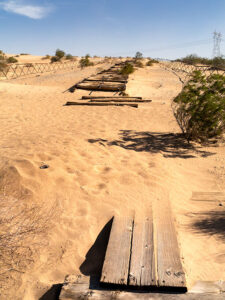
Plank Road - You can see what's left of the old plank road on display at Gordon's Well.
Plank Road – You can see what’s left of the old plank road on display at Gordon’s Well.

The road builder’s solution for getting across was to build a plank road—movable wood sections on railroad-lie ties that floated on the sand’s top. It turned out to be challenging to maintain, but it drastically cut the crossing time when it was clear. Eventually, the planks were replaced with new and expensive asphalt, and eventually, it became Interstate 8. There is a section of the original plank road at Gordon’s Well on display. When you grow tired of looking at the old wood road, you can walk over to the border wall and lean on it.
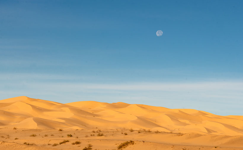
Dune Moon - A waning gibbons moon setting over the Algodones Dunes west of Winterhaven, California.
Dune Moon – A waning gibbons moon sets over the Algodones Dunes west of Winterhaven, California.

As Anne and I drove west on the freeway, we spotted a waning moon setting on the dunes, so we looked for a place to stop. We’ve got stuck in these sands once before, so we were careful not to drive off the blacktop. I didn’t want to pay for another hook to come to yank us out. As you can see, we found a good spot and took this week’s picture called Dune Moon. The name could have been funnier if I had shot it during a particular summer month. Se la vie.

You can see a larger version of Dune Moon on its Web Page by clicking here. Next week we drive north up the Imperial Valley to visit the northern dune crossing. Be sure to come back and see what we found.

Until next time — jw

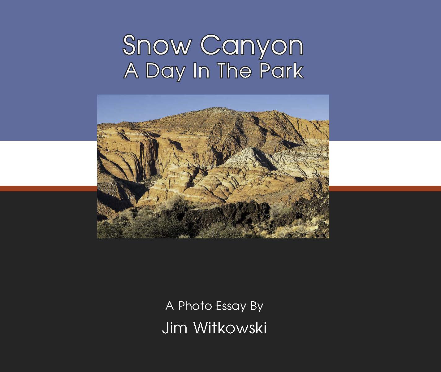
Snow Canyon—The Book      New book announcement

Do you remember from my first of this month’s post—Stacked Arches—where I said, “There’s enough to photograph within the park’s boundaries to fill a small picture book?” Well, there is—and I have—so I did. This short particular midweek post announces my latest book—Snow Canyon.

Snow Canyon - The Book - my latest book will be released next week, but you can get a sneak peak by clicking here.
Snow Canyon – The Book – my latest book will be released next week, but you can get a sneak peek by clicking here.

They haven’t released it yet; that will happen sometime next week on Amazon. It’s available in two versions. The first is a hardcover with a dust jacket. The paper I used was the best offered, so I expect the photos reproduction to be outstanding. The second variation has a soft cover and is printed on upgraded paper stock.

It’s a self-published book, like my others, so, unfortunately, its cost is prohibitive—unless you want to buy 100 copies or more. However, I wanted you—my subscribers—to enjoy it, so I’m providing a link to a free version in PDF format as a way of saying thanks for hanging out with me.

Once you download the PDF (2MB), you can read it, print it, tape it to your fridge, or line your parrot cage. It’s yours to do as you wish. Get your copy by clicking on the cover shot above or on this link: Snow Canyon—The Book.

I hope your New Years’ celebration is safe and sane. I’d like you to be around next year when we go to many exciting new places.

Now, we will return to our regularly scheduled programming.

Until next time — jw

Cup Holders Picture of the Week

I will pause our Snow Canyon State Park tour for a couple of paragraphs so we can run over to the coast. Don’t worry; we won’t have to put up with any of those weird Californians. Where we’re going, they don’t exist yet. We’re not traveling far—maybe a foot or two. However, we are breaking every law in physics to travel back one-hundred-eight million years ago—to the Jurassic era. You can turn around now and take in the Sundance Sea, right here in southern Utah (how old is Robert Redford anyway). Don’t go in the water. Big things in there will eat you like you’re a gummy bear.

Turn back this way and look down the shoreline. Massive dunes—hundreds of feet high—go on for hundreds of miles. Until now, it’s been hot and dry here along the Equator, but the climate is changing. It’s becoming muggier and swamp-like. The oceans are rising, and soon (in geological time), the water will cover the sand and pile more sediment. The pressure on the dunes will bind them into stone—never to be seen again.

Things would have stayed that way, except our stupid captain rammed the North American plate into the Pacific Plate, and there goes the neighborhood. The crash spun us around and raised the Rockies, the Sierra Nevada, and all the other little wrinkles in between. The resulting damage cracked the mantle so badly that volcanoes could form, raising the Colorado Plateau. Then the Californians move in—can it get any worse?

The crash shoved our peaceful little seaside village up a hillside. We no longer live in a basin where sediments collect. Now, our water flows to a place far away. It peels back layers of rock—like an onion when it does. After erosion uncovers parts of the great dunes, we’ll see them again here in St. George, Zion, and north of Escalante. Now they’re as hard as a rock.

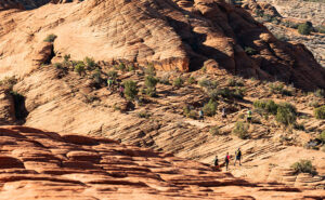
Dune Walkers - About the only way you can stay on the Petrified Dune Trail is to go on a guided hike, like these people.
Dune Walkers—The only way to stay on the Petrified Dune Trail is to go on a guided hike like these eight people.

You can snap out of it now and return to reality, where we’re standing on the Petrified Dunes Trail. Because it’s all rock, the only clue you have to follow is the path worn smooth from countless boots. It’s easy to leave it, but that’s fine because you won’t damage anything. The rock grips like sandpaper, making it easy to scramble up and down the slopes. As you wander across the uniformly fractured rock, you examine the exceptions.

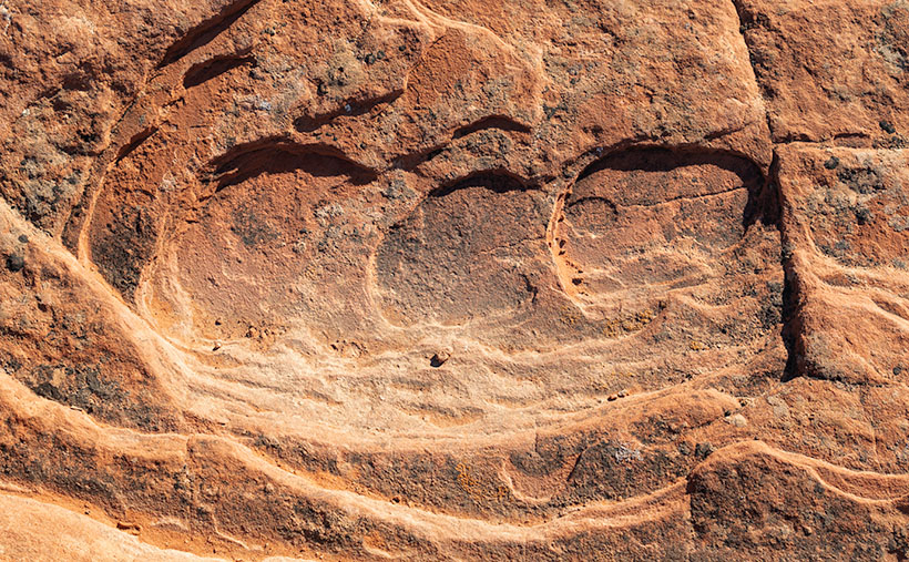
Cup Holders - Freezing water bores into the sand stone and will over time reduce the rock to sand grains.
Cup Holders – Freezing water bores into the sandstone and reducing the rock to sand grains over time.

That’s how I found this week’s picture. The round wells in the picture are places where water is collected and has a chance to freeze. As the ice expanded, it fractured the sandstone and chipped it. These spots get deeper; they’ll hold more water and bore into the stone faster. Eventually, they’ll be so deep that they’ll split the block until it reverts to sand grains. I think the shapes of the cups are fantastic, but I like the rich and varied colors in the stone. When you look closely at this, sandstone has a lot of depth and texture.

Click here to see a larger version of Cup Holders on its Web Page. Come back next week when I’ll tell you about how the stupid captain left the kettle on too long and spilled hot lava all over the park.

Until next time — jw

Thumb Butte Picture of the Week

Arizona State Route 68 in Mohave County has substantially improved since I first visited Bullhead City decades ago. It was a two-lane back road with faded markings and crumbling tarmac. When it rained, it was impassable because the highway ran through the flooded wash bottoms. These days, it’s a mini-interstate with four lanes and no lights or signs along its 28-mile length. It’s impressive how infrastructure improves when it involves getting people into casinos.

SR 68 also has one of the best views of all the roads I’ve traveled. That vista comes just west of Union Pass in the Black Mountain Range. When you see the Union Pass elevation sign (3570 feet), you can tell it’s coming. There is a wide shoulder here to enable truckers to safety-check their brakes. Immediately after you clear the mountains on either side of the highway, you can see a panoramic view of the Colorado River 3000′ below. Beyond the blue water ribbon, you can see into the Nevada Desert going on forever—especially now that APS has dismantled the coal-fired Mohave Power Station. You don’t have long to enjoy the view because suddenly you’re on the downhill side of the roller coaster, and just for giggles, the highway department put a stoplight at the bottom of the 11 miles of 7% grade.

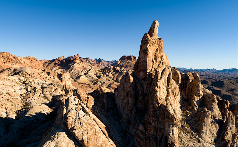
Thumb Butte - An 800' tall granite monolith overlooking the Colorado River above Bullhead City.
Thumb Butte – An 800′ tall granite monolith overlooking the Colorado River above Bullhead City.

As you descend into the river valley, a thing that jumps out at you is an 800′ tall granite monolith on the left side of the road. It’s called Thumb Butte on the maps, but many locals call it Finger Rock. It’s visible in both towns—Bullhead City and Laughlin—and from there, it looks like the universal gesture of ill will, the big bird, the highway salute, or whatever your favorite euphemism for the middle finger is. (There is another landmark a couple of miles south officially named Finger Butte—don’t confuse the two.)

I have wanted to photograph the rock before, but my schedule prevented me from stopping. On this year’s trip, I decided to make time. I watched videos, poured over the Topo maps, and found a Jeep Trail that goes right by the tower. So, late afternoon, Archie and I drove the dirt trail and took this week’s photo, which I call Thumb Butte.

I wanted to capture some depth and texture, so I shot the rock from the north side, looking into the Mount Nutt Wilderness Area. I’m happy with how this image captures the rugged terrain of the Black Mountains—if only a tiny sample. Maybe I should regularly go back and work the entire range—from Needles to Hoover Dam. What do you think?

You can see a larger version of Thumb Butte on its Web Page by clicking here. Please return next week when I show another photo from Union Pass and SR 68.

Until next time — jw

Sycamore Point – and – Calendars     Picture of the Week

Trick or Treat
smell my feet
give us something good to eat

Since this is my first-ever Halloween post, I couldn’t pass that up.

So, where were we? Oh yes—Queen Anne and I spent an afternoon exploring and photographing along the back roads to Sycamore Point. The sun was going down, and we wanted to get back to Williams to have a nice dinner at The Red Raven Restaurant.  Before we leave, let me get in one more shot.

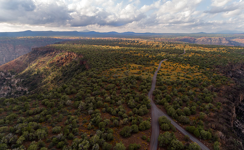
Sycamore Point - From Sycamore Point, looking back over Thumb Flat to Bill Williams Mountain.
Sycamore Point – From Sycamore Point, looking back over Thumb Flat to Bill Williams Mountain.

I call this week’s photo Sycamore Point. If it isn’t apparent, I took it with my drone. Unlike a normal camera, you can’t spontaneously whip it out and start flying about—well, not if you want to keep your license. You have to file a flight plan, conduct a pre-flight check, and there are no fly areas. In this case, I couldn’t fly it past the wilderness boundary (you can get an exception from the BLM—but that takes weeks).

The truth is that I took several drone shots of the canyon, but because the drone’s camera lens is ultra wide, the images from my Sony were better, so I used those. Since the drone had battery time left, I turned it around and pointed the camera toward the road we traveled. From an altitude of two-hundred feet, this is the image that I got.

When I started processing this photo, I realized that it has everything that we’ve been talking about during October. In one image I see Alligator Juniper, patches of yellow wildflowers, Thumb Flat, the edges of Sycamore Canyon, burn scars, the back road, shafts of sunlight, and in the distance, the Northern Arizona Volcanic Field—including Bill Williams Mountain (center left) and The San Francisco Peaks (far right). It’s like you’re back in school, and here’s the chapter review before the test—but from a different perspective.

You can see a larger version of Sycamore Point on its Web Page by clicking here. Next week, it’s time for a new project from a different location. You’ll want to come back and see what trouble I got myself into this time.

Calendars

This year is hurtling to an end already, so it’s time for me to make new calendars. In spite of the extra cost last year we got a nice response. Inflation has taken a toll again this year. After reviewing my printer’s price list and post office shipping costs, I need to charge $20.00 for them. I know that cost is prohibitive to most of you, but they’re a limited item. I need to get one for myself and if you’re interested, I’ll print a copy for you.

The pictures for the 2022 edition are from this year’s outings. The size remains the same—6 ½ inches high (each half—about the size of a sheet of paper folded in half) and 8 ½ inches wide, and they have holidays noted on the dates. They’re printed on card stock—which is part of the expense.

In order to get them to you for Christmas (and we’re cutting it close according to the Post Office), I need to know by November 10th. If you’d like one, you can leave a comment in this post, use the contact form on my website (https://www.jimwitkowski.com/junk/index.php), or email me directly. Don’t forget to leave your contact information if I don’t already have it.

Until next time — jw