Saguaro at Harquahala Mountain Picture of the Week

I was researching today’s post, and I found some interesting statistics—at least they are for me—and on an online forum thread that made me smile. In case you hadn’t noticed, I like mountains. I like them big or small, a long chain of peaks or lonesome butte, snow-covered volcanoes or desert ranges. I like them because they’re not flat and they’re visually stimulating. You can gauge travel distances with them. I’d be a terrible mariner out on the sea without landmarks. When I travel through Kansas, I have to replace peaks with grain silos.

I want to learn more about what I see and photograph. I want to know the peak names, their heights, their make up, and how they formed. Most of my curiosity is satisfied with topographic maps, but the geology stuff is gobbledygook.  I wish there were an easy decoder book written for simpletons like me.

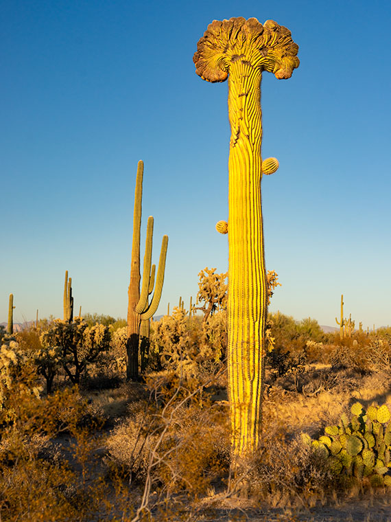
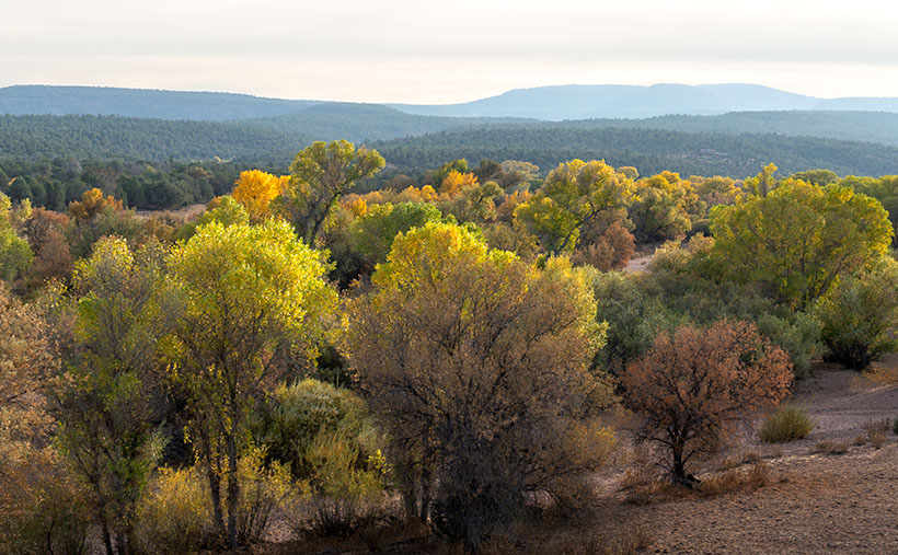
The Harquahala Mountains—the subject of this month’s images—are a substantial range, one of the highest in Arizona’s southwest quadrant. I can see its distinctive round shape from my back porch. I started tagging my films with the name Harquahala Studios because it’s fun to say: HARK—qua-hala. Last week I learned that the name in the Mohave language means “water, up high” presumably from the springs on its slopes—a handy fact to know if you live in the desert.

I Googled “Arizona Mountains” this morning and found it listed in the 5,000-6,000 foot elevation group. To find the exact answer that I wanted would have required more research, spreadsheets, and an effort that cut into my nap, so I gave up. But I saw another question in the list that piqued my curiosity. “Which state is most mountainous?” What’s your guess? Set aside Alaska because they don’t play fair. Is it Colorado, California, or Montana? In the discussion, some people were arguing that it’s West Virginia, which is in the Appalachians, and the highest peak is under 5,000 feet—hardly a mountain. They explained that the little state has the lowest percentage of flat-land, so it’s all mountains, therefore the most mountainous.

The answer wasn’t Colorado; California has 500 more named peaks, and Montana is two-thirds prairie that the locals call West Dakota. The response surprised me, but since I read it on the internet, it must be true. Being entirely comprised of the Great Basin Desert with north-south running ranges, Nevada has the most named peaks in the lower forty-eight. They’re not the highest, but there’s a gob of them.

Saguaro at Harquahala Mountains-A line of saguaro looking like telephone poles lead your eye to the massive mountain south of Aguila, Arizona.

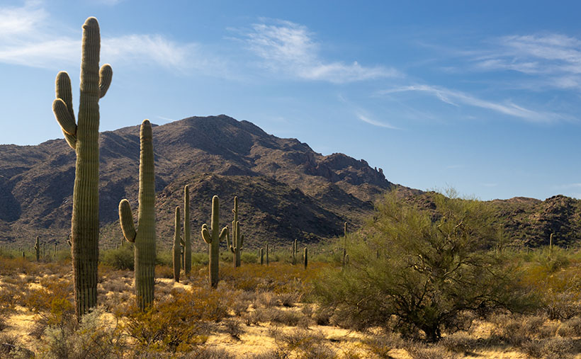
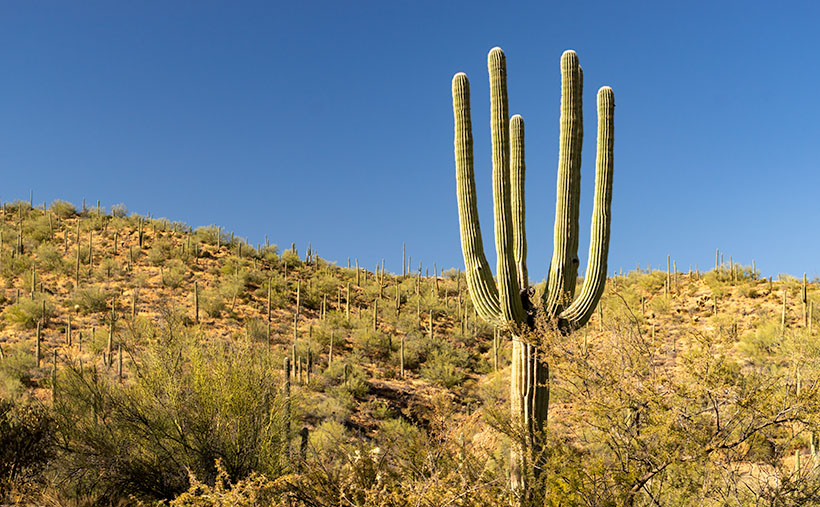
This week’s featured image is called Saguaros at Harquahala Mountain, and I shot it south of Aguila, a few miles south of the Eagle Eye Peaks in last week’s post. What made me stop to take this image was the line of saguaros that looked like a row of telephone poles. They create what’s called a leading-line—a perspective tool that brings your eye into the massive mountain. The clouds and the small Palo Verde tree work to keep your attention in the picture’s center—if it works right, your eye moves in a clockwise circle.

You can see a larger version of Saguaro at Harquahala Mountain on its Web Page by clicking here. I hope you enjoy viewing it. Join us next week as we continue our lap around the Harquahala Mountains, and remind me to stay out of the flooded washes.

Until next time — jw

Crested Saguaro Picture of the Week

Queen Anne and I left The Boulders—the subject of last week’s post—continuing west, and within a mile, we reached the side road to Cochran. It goes north to the ghost town on the Gila Riverbank. Unfortunately, nothing remains except a few foundations and several beehive ovens used to produce coal for the mines. However, the ovens are on the north side of the river, and there isn’t a crossing short of wading through quicksand. I want to reshoot them, but the trail coming in from the north is too much of a challenge for Archie.

The other notable thing about the Cochran intersection is that the Florence-Kelvin Highway becomes paved. That meant we could roll down the windows and pick up the pace, although I’ve never heard of anyone who has ever been in a hurry to get to Florence. The long, straight road follows the gentle western-facing slope into town, and you can’t help but notice how the vegetation packs the desert. Groves of saguaro, cholla, prickly pear, staghorn, and ocotillo make it treacherous to hike cross-country, but there were still cattle out there picking at sparse patches of grass.

The day was late, and there were no impressive mountains around, so I’d given up on photography and was paying attention to the road when I saw something in my periphery that made me skid to a stop.

“What is it? What did you see?” Anne said, waking from her slumber.

“I’ve seen pictures of these, but I’ve never seen one in person. I got to get me a photo,” I was excited and up in the pipes. I grabbed the camera and walked a short distance from the road. Among the dozens of saguaro standing around like they were at a cocktail party was my first crested saguaro. In the evening sun, aglow looked like it had put on a shawl and got a fresh hairdo like it knew I was coming to take its portrait.

Crested Saguaro - My first sighting of a crested saguaro out in the wilds of Pinal County.
Crested Saguaro – My first sighting of a crested saguaro out in the wilds of Pinal County.

Crested saguaros are rare, and no one has a conclusive answer for what happens. Some biologists say lightning strikes, while others guess freezing or genetic mutation. According to the Saguaro National Park Web page, of the thousands of cacti there, only 25 crested ones have been identified. Like humans and snowflakes, the saguaros are unique individuals. I could build a career by photographing them, but better photographers than I have already done that. However, you can bet I’ll collect every crested saguaro I see, like baseball cards.

Click here to see a larger version of Crested Saguaro on its Web Page. I hope you enjoy viewing it. As you know, Thursday is Thanksgiving, so Queen Anne and I will be surprising a lucky Deneys somewhere in Arizona. If we have too much fun, next week’s post might be late. We’ll be writing about a new road we’ve traveled, so it’ll be worth the wait.

Until next time — jw

The Boulders Picture of the Week

As we continue our journey east along the Florence-Kelvin Highway, we leave behind the dry washes and haunted valleys of the Tortilla Mountains. We reach a crest where the land becomes a flat plain of sorts. There are small mountain peaks—big hills really—dotting the countryside here and there, but the view is more open, and it seems less appealing now.

Without the mountains and gulleys, the road has long straight sections, and although it appears to be flat, it’s a long downhill slope into Florence. The elevation drops almost a thousand feet over the next ten miles. Just after passing the Tea Cup cattle ranch on the road’s north side, we spot a field of granite boulders that Google Maps identifies—oddly enough—as The Boulders.

The Boulders-Another outcrop of granite deposit found throughout the state of Arizona.

The boulders that you find at The Boulders are the same pile of granite rocks found in Prescott, up the hill from here in Yarnell, Kingman, or any other place throughout Arizona. They’re everywhere. Instead of turquoise, the state legislature should have designated these granite deposits as the state gemstone, but, like Ben Franklin’s idea of making the turkey the national bird, granite just lacks pizzazz—except on your kitchen countertops.

Because the rocks stand out like a sore thumb along the road, I had to stop to take some more rock pictures. There are a couple of good campsites here. In fact, on our visit, a motor-house and fifth-wheel were doing just that nearby, so The Boulders is a popular place. As I clambered in, on, and among the rocks, I looked for a composition that distinguished this outcrop. The image that I chose to present this week was one that was covered with graffiti. I’m always flabbergasted how some people love to get out in the wild and are then compelled to mark it up with spray paint.

I call this week’s featured image The Boulders, and I like it for a couple of reasons. One is the contrast of small against the big; the other is the shadow against the light. I’ll throw in the wall-art at no additional charge. Another thing in this image that I find interesting is the Tortilla Mountains barely visible on the horizon. It shows the amount of distance Queen Anne and I have traveled.

You can see a larger version of The Boulders on its Web Page by clicking here. I hope you enjoy viewing it. Next week, we’ll finish up our trip along the Florence-Kelvin Highway and I have a surprise to show you—something I’ve seen in pictures, but never in person.

Until next time — jw

Headless Saguaro Picture of the Week

Headless Saguaro - An unusual saguaro that lost its trunk and has six arms instead. I wonder how that could have happened.
Headless Saguaro – An unusual saguaro that lost its trunk and instead has six arms. I wonder how that could have happened.

Several decades ago, there was a miner that lived in a cabin in the desert foothills east of Mesa, Arizona. He was raising three children on his own because the wife took sick with influenza and died. The children were terrified of him because he liked to hide his head under his coat, sneak up behind them, and frighten them with a shriek. “I am the headless horseman, and I’ve come to take you away!” They would always run screaming to the cabin and hide under the bed. He was mean.

One Halloween, there was a knock on the door. When the miner answered it, he was staring into the eyes of an evil witch—his mother-in-law (been there). Because he knew he had done wrong, and realized it was the start of a war of which he wanted no part. He pushed her aside and set off for the town bar. “They’re your charge now,” he yelled back at her as a dream of a new life flashed through his brain.

As he walked away, the children, curious about the commotion, peeked from the bedroom. When they saw it was their grandma, they ran and clung to her skirt. They talked over one another about how mean father had been since mom died. Then, in turn, they each told stories on him. These grievances enraged grandma, and she rose up to a towering height, her skin turned green, and her eyes glowed red—for, after all, she was an actual witch. Because the miner already had a head start, she needed a wand to cast a spell. She searched the kitchen until she found a box of plastic straws. After grabbing one, she ran to the door where she could barely make out the miner’s figure at the far end of the valley. She knew she was clutching at straws, but the witch raised her makeshift wand to the sky and began a dreadful curse. “Since you enjoy the road, your feet will be forever planted there! You will have a pair of arms for each of your babies, but will never get to hold them! Because you conjured a headless horseman to frighten the children, you will lose the empty one you have! You will grow spines to go with your prickly disposition, and your skin will turn green!”

And that’s how Dave—the headless saguaro—came to be at this spot along the Florence-Kelvin Highway. He’ll probably stay here for another couple of centuries, providing a home for Gila Woodpeckers and Pigmy Owls. Dave’s only worries now are housing developers or being struck by lightning a second time. And what about the kids? Oh, grandma moved in and fattened them up with lots of sugar and spice before she shoved them into the oven and baked them into gingerbread cookies for Santa to eat on Christmas Eve. What did you think was going to happen? I told you she was a witch.

You can see a larger version of Headless Saguaro on its Web Page by clicking here. I hope you enjoy viewing it. Next week, we’ll continue along the Florence-Kelvin Highway, and I’ll show some more of the natural beauty we found along the way.

Until next time — jw

Ray Tailings Picture of the Week

Queen Anne's directives - From her royal coach, Anne delights in pointing the way we should've gone.
Queen Anne’s directives – From her royal coach, Anne delights in pointing the way we should’ve gone.

Picking a new back road to explore, photograph, and talk about is easy for some months. I may have seen a place that piqued my curiosity, and I’m ready to go. Other months are hard. I’ll pour over my maps, hoping to find inspiration. This month was different. When Queen Anne told me that she wanted to visit an ex in Florence (1), I knew right away which trail we’d be talking about in November. Of course, we’d pick the Florence-Kelvin Highway.

The highway between Florence and Kelvin is a 34-mile shortcut between the towns. Although it’s 13 miles shorter, driving around the Tortilla Mountains and through Superior using the paved highways is faster. I’ve partially traveled this road before when I photographed the Cochran site—the ghost town where only the coke ovens remain. They paved sixteen miles of the highway between Florence and the Cochran Road. It’s a long gentle grade rising 1500 feet. Then it winds through the Tortilla Mountains, past a couple of ranches, before descending into Kelvin—a small community along the north bank of the Gila River. Although there may be some wash boarding between gradings, the dirt is broad and doesn’t require a particular vehicle.

On this trip, Anne and I drove east to west, so we’d be somewhat closer to home. From Congress, we drove two and one-half hours to Superior, and most of that time was spent getting to the other side of Phoenix. In Superior, we turned south on County Road 177 to Kelvin—a community so small it doesn’t even have a Dollar Store. Something that Kelvin does have is the Ray open-pit copper mine currently managed by the Mexican mining company, Asarco. And it’s where I photographed this week’s featured image that I call Ray Tailings.

Ray Tailings - A 500-foot tall inside out mountain of mine tailings.
Ray Tailings – A 500-foot tall inside out mountain of mine tailings.

This operation is so massive that you see it on the east side of the highway for a couple of miles. The central pit—Jimmie Luck Gulch—looks like it could be used to mold giant Devo hats (“Whip it good“). In the middle of the Dripping Spring Range, the mineworkers have dug a negative mountain with terraces that the behemoth trucks use to haul ore to the surface. Digging that much dirt out of the ground to remove the copper, you have to stack the sterile waste somewhere, and that’s what I photographed for this week’s issue. It’s the mountain stacked up—inside out. The minerals found beneath the surface colors each layer. To me, the 500-foot pile looks like a gay-pride wedding cake.

It’s an impressive bit of technology to see, but it also causes environmental problems. Because the rocks and dirt are devoid of nutrients, unless scientists intervene, it will take centuries for plants to colonize the tailings. So that makes them susceptible to accelerated erosion. With each heavy rain, bit by bit, the pile makes its way into the Gila River and eventually the Sea of Cortez. That’s not good for the downstream people who rely on the river for clean water (Arizona Copper Co. vs. Gillespie).

You can see a larger version of Ray Tailings on its Web Page by clicking here. I hope you enjoy viewing it. Next week, we’ll continue along the Florence-Kelvin Highway, and I’ll show some of the natural beauty we found there.

Until next time — jw

(1). For those of you that live in another state, or don’t get the joke, Florence is the location of Arizona’s State Prison. She doesn’t really know anyone incarcerated there, but that’s not as funny.

Granite Mountain Picture of the Week

Fall on the Humphrey Wash- Usually the high-country aspen trees get all of the attention for their fall colors, but every so often, you can find some subtle color along the road.
Fall on the Humphrey Wash- Usually, the high-country aspen trees get all the attention for their fall colors, but occasionally, you can find some subtle colors along low-land roads.

This week’s featured image (below) is the last from our Camp Wood Road excursion. It was taken a few miles from the route’s junction with Williamson Valley Road—also known as Yavapai County Route 5. You’re still in the middle of nowhere when you arrive at that intersection. Iron Springs is 22 miles south, Seligman is 30 miles north, and all dirt roads. I’ve already made a note of it for a possible future trip.

From the Sheridan Fire area, I talked about last week, Camp Wood Road descends from the pine-covered hills and mountains into Prescott’s flat grasslands. It’s a natural location for the sprawling cattle ranches of the past, and now it’s the target of developers selling one-acre McMansions. When I traveled to this area as a younger man, I could frequently spot grazing antelope. They’re a rare sight these days, and that makes me sad.

When Queen Anne and I set off on this photoshoot, we spent more time getting to Camp Wood than I estimated. It was already after sunset by the time we reached the road’s end. As we drove in the dim light, I knew I wanted to include the open grassland in the Camp Wood story, so we made a second trip. This time, we drove counter-clockwise—which is more accessible and a much faster way to get there. However, on the second drive, the sky was overcast, and someone had set the Bradshaw Mountains ablaze, which filled the air with smoke. I wasn’t optimistic about getting good shots. As it turns out, the fire was only a controlled burn, and the fire crews had it out by the afternoon.

We found another change when we reached an area called Humphrey Wash on my maps. The broadleaf trees started turning color in the intervening weeks between our visits. Of course, this is Arizona, so they weren’t the bright colors you’d see in New England, but they were still worth getting out of the truck and getting them on film.

Granite Mountain
Granite Mountain – Under a vast sky filled with broken clouds with lingering smoke, Granite Mountain dominates the southern horizon from the Las Vegas Ranch in Williamson Valley.

Further east on Camp Wood Road is a large ranch with two driveways. It’s the Las Vegas Ranch, and one of the entrances is along Camp Wood Road, while the other connects to the Williamson Valley Road—a dozen miles away. When we arrived, the sun was low, the overcast began breaking, and Granite Mountain was predominant on the southern horizon. I took two versions of that scene, but I think the second was better because of the cottonwood trees lining an unnamed wash. I called it Granite Mountain, and I wanted to show the Prescott grassland’s open space. Just as it is in real life, the sky dominates everything. In this photograph are all of the elements of that visit: the broken clouds, lingering fire smoke, Granite Mountain, and the vast open plain. I hope you enjoy it.

Click here to see a larger version of Granite Mountain on its Web Page. I hope you enjoy viewing it. It’s the start of a new month next week, so we’re off to explore a different Arizona back road, so be sure to come back and see what we’ve discovered.

Until next time — jw

Sheridan Manzanita Picture of the Week

Camp Wood Ponderosa - The late afternoon light adds a glow to a ponderosa pine grove at Camp Wood.
Camp Wood Ponderosa – The late afternoon light adds a glow to a ponderosa pine grove at Camp Wood.

East of Camp Wood, the road is wide and smooth as it rolls through the Santa Maria Mountain foothills. There are a few isolated places with washboards, but it’s quiet enough you might think that they paved it, although the plume of dust you see in the rearview mirror proves otherwise.

Queen Anne and I visited here the week after a heavy rain, so it packed down the dust, but the roadside troughs were full of debris. As we drove further, it looked like road crews had hosed the gutters with oil, because they were so black. We questioned if that was to keep the dust down, or were they preparing to pave the east end of Camp Wood Road. As soon as I got those questions out of my mouth, we rounded a bend and found a scene of utter destruction. On the north side of the trail, everything was normal, with pinions, chaparral, and gamble oak covering the landscape, but the south side was black and barren. Only charcoal-colored tree skeletons dotted the hills and valleys.

This road section was the location of the lightning-caused Sheridan Fire—one of those forest fires you watch on the evening news as they bomb the countryside with a fire retardant. The reporters tell you it’s near Prescott—but they’re always near Prescott—and it’s so remote that you don’t pay much attention. The fire started on August 5th, and it burnt through 22 thousand acres until early September rains finally put it out. I’ve never visited such a fresh burn site. Unbroken black ash covered the ground, and the rains washed some of it into the road gutters. The Forest Service blocked all of the side-roads, and hiking trails leading south with signs warning of fire danger.

Because Camp Wood Road is so wide here, it worked as an effectual fire break. The stark contrast between the left and right sides of the road drove home the destructive power of a forest fire. Although it looks like a barren wasteland now, within a few weeks, grasses will begin to sprout, and the fire area will renew itself. That’s how nature works.

Sheridan Manzanita - Red bark manzanita burnt in the 2019 Sheridan Fire near Camp Wood, Arizona
Sheridan Manzanita – Red bark manzanita burnt in the 2019 Sheridan Fire near Camp Wood, Arizona

When we got to a place where I could see Cottonwood Mountain as a backdrop, I stopped to take a few images. My favorite of the group is this week’s featured image. It shows burnt Manzanita skeletons in front of the flat-top mountain. Manzanita is one of my favorite plants because of its mahogany-colored bark, as you see in the photo. It only grows at higher altitudes in Arizona, and it’s hard to photograph because its dense round green leaves always hide the brightly colored branches. I called this image Sheridan Manzanita, and I hope you enjoy viewing it.

You can see a larger version of Sheridan Manzanita on its Web Page by clicking here. I hope you enjoy viewing it. Next week, we’ll make another stop along the Camp Wood road for yet another change of scenery. I hope you’ll join us.

Until next time — jw