Laughlin, Nevada

Every once in a great while, I’m allowed out of the house on my own. I know that’s a surprise to you, but there are times when the Queen has friends over and she wants a presentable house. That means I have to go away while her company is here. Since I’m doing Anne a ‘favor’, I can usually parlay it into an overnight trip that I call a photo shoot. One of these freedom nights was last Tuesday, but at the last-minute, her friends had to postpone, and she was already in the truck before I could get out of the driveway . . . Doh!

My friend Deb asked if this was an anniversary trip to which I replied, “What? When is our anniversary? Yeah, that’s it! It’s for our anniversary.” So, it was something I had planned all along.

Whenever I have a chance to get away, my first thought is to head for a body of water. After all, that is what we miss in the desert. I’d hop on the first plane to New Zealand if I could afford it, but that’s out of our budget. What we can afford is a cot at the YMCA . . . or something close to that. With those constraints, there’s always Laughlin, Nevada.

Colorado River Valley from the Black Mountains.
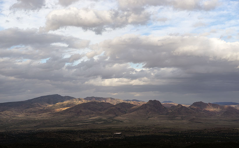
On a rare rainy day, the lower Colorado River Valley holds the communities of Bullhead City in Arizona, and Laughlin on the Nevada side of the river.

My parents were the ones that introduced me to Laughlin. In the late ‘70s, they had a second home in Bullhead City, the town on the Arizona side of the Colorado River. My dad kept his boat there for a while, and we would manage to ‘drop in’ while they were in town. We’d spend days fishing and water skiing on Lake Mohave, and in the evenings, we would take the water taxi across the river to one of the three casinos on the Nevada side. I have fond memories of those times. Good times never last however, and my parents eventually got rid of the house and boat.

There are several reasons for me to make a quick trip to Laughlin. As a fisherman, both Lake Mohave and the river below Davis Dam offer good angling. However, I never remember to pack my gear for a one night trip. Although I like the craps table, I am averse to wasting money. It used to take twenty bets to lose my bankroll, but now that the tables have a five buck minimum bet, I’m done in four rolls. So, I don’t spend much time in the casinos. There are the buffets with rows and rows of various foods, with people who make you look skinny by comparison. However I favor quality over quantity, so we avoid them. I guess the best reason for Laughlin is that now that the Queen and I retired, we can take advantage of the twenty-five buck midweek hotel rooms. You can’t stay at the YMCA for that price.

The cheap rooms have a downside too. As we strolled along The River-walk connecting the casinos, we noticed that most of the patrons were at least our age; silver-haired seniors and an abundance of canes, walkers and wheelchairs. All of the casino floors were empty with many of the tables covered. The prime restaurants only open on the weekends. The hustle, bustle and excitement you would expect from a gambling hall was missing. Then, it dawned on me that the only people who had time for a casino on Tuesday were retirees; everyone else had to go to work . . . duh!

Thumb Butte
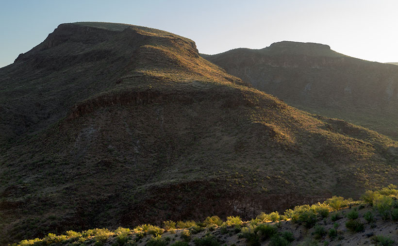
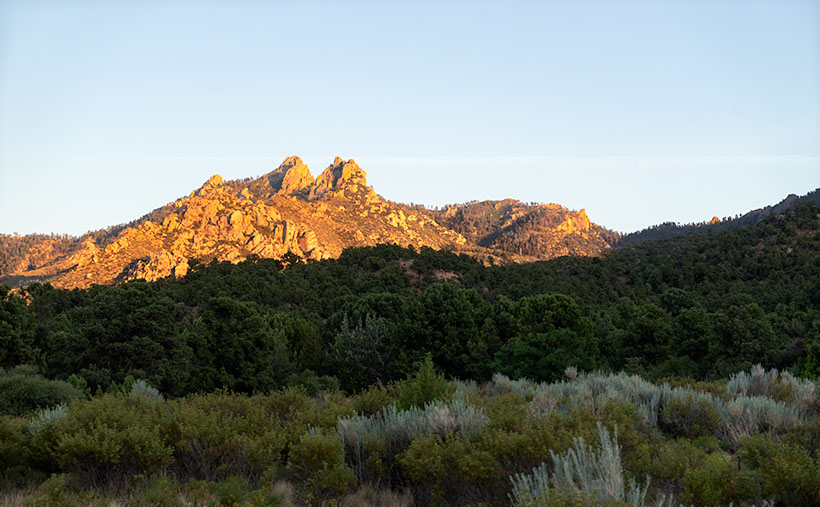
In the Black Mountains above Bullhead City, Thumb Butte looks like the universal indignant gesture of ill-will.

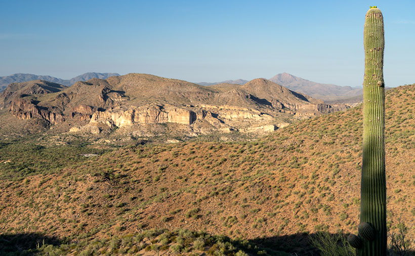
There’s one last thing that fascinates me about the area; it’s the geography. That section of the Colorado River Valley runs between the Black Mountains in Arizona and Nevada’s Eldorado Mountains. Neither range I consider tall, but they’re at the north-eastern reach of the Mojave Desert and get very little rainfall. That means they are subject to wind and temperature erosion. They are rocky, jagged and very rugged. Almost impenetrable.  As a matter of fact, Interstate 40 makes a 20 mile detour along the Santa Fé railroad tracks, around the Black Mountains between Needles and Kingman. The next upstream river crossing is 60 miles north at Hoover Dam and then its 180 miles more to the bridge at Marble Canyon. At the turn of the 20th Century travel was even worse. There were no bridges between Needles, California and Moab, Utah. Everything in between is hostile, desolate and in my opinion, the most beautiful terrain on earth.

Black Mountain MIne
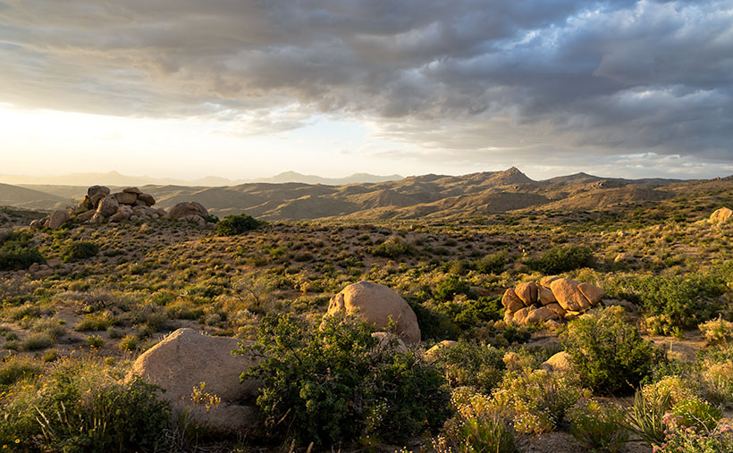
An old mining claim near Union Pass in the Black Mountains.

As a photographer, I see the Black Mountains as a choice place to shoot pictures. It has ragged peaks, soaring spires and interesting shapes. They’re passed by in favor of the more famous canyons the Colorado cuts through. Because of its relative closeness, I’m intrigued at its beauty and if I can figure out how to best capture that ruggedness, I may have to take it on as a future project. Hey, it’s an excuse to get out of the house.

Till next time . . . jw

Yuma Again

Queen and I did our quarterly dentist run early this week. I’ve already talked about Algodones, so I don’t want to discuss the border town again, except to say that the weather has grown much warmer and the snowbirds that flock to the western Arizona counties have grown thin. The lines at the Customs Station are nil. We were able to get on the road home by 2:30 yesterday.

Today I want to talk about a couple of Yuma bright spots. There aren’t many, so when I find one, it’s a pleasant surprise. Yuma has a Marine base and in winter when the snowbirds arrive, its population triples . Other than that, most people only get off the interstate to top off the gas tank on their way to San Diego (or back).

If our dental visits call for lab work, we’ll book a room in a chain motel. Most of them include a (so-called) breakfast. Generally the fare consists of packaged microwave rubber omelets, assorted cold cereal, fruit, waffles (if you’re lucky) and/or toast and bagels. At best, it’s airline food, but it saves having to walk across the street to Mickey D’s. That’s what we did until our last trip when I convinced Anne to forgo the buffet for Brownie’s Café.

Browies Cafe
The place ain’t swank, but the place is always crowed and the food is old-fashioned good. Locate on South 4th Avenue off Interstate 8.

My first meal at Brownie’s was on a solo trip to Yuma. While exploring south 4th Avenue one morning, I spotted the large Café sign and thought that it would be really good or really bad, so I stopped to find out. The packed parking lot is usually a good sign. I stopped again with Jeff on our photo trip to the Salton Sea a couple of years later. After two more meals with Anne, I’m convinced it’s a gem right out of The Twilight Zone.

It’s a counter diner from the 1950s. The back dining area, crowed with tables and booths, is always filled with patrons, but on weekdays, you can usually find an open table. As you look around the room, you’re assured that this isn’t a campy place nostalgically decorated; this is the real thing and has probably been this way for thirty years. The building and the decor have been there for a while and they show wear. To put it bluntly; this is not a shiny new place. If that’s a key point of yours, go somewhere else.

In the table’s center are four beige half-inch thick industrial ceramic coffee cups. When you turn one right-side-up, the wait-staff instantly fills it without asking as they deliver the menus. The menu nothing fancy on it; instead there are all the items you’d expect. The plates are not large, but the food is properly cooked, just as you ordered.

My favorite is the Walt Kammann Sausage and eggs. The sausage is from a local butcher that has made it for over fifty years. It’s similar to a brat but spicier with flavors like linguica (Portuguese sausage) and lots of  fennel like you find in Italian sausage. The sausage is a point of pride in Yuma.

Yuma Mural
Anne checks her cell phone by one of the murals at Yuma Landing.

North of Brownie’s on 4th Avenue is a place called Yuma Landing with a Restaurant of the same name. I had always assumed that the name came from nautical origins, probably from Colorado Steamboats or something of that sort. I was mistaken. When we stopped to look at a monument, I found out the name comes from early aviation. In 1911, pilot Robert Fowler landed the first airplane ever in Arizona on that site. He was on a cross country trip flying a Wright Model B biplane which he completed in Florida forty-nine days later. The place has a plaque, a statue of Mr. Fowler and a couple of cool murals. It’s a big deal for Yumans . . . probably because nothing else interesting has happened in Yuma since.

Till then . . . jw

Fred and Jim’s Excellent Misadventure

My friend Fred got a new toy for his birthday. For the last couple of years he’s been lusting for a SUV (Sport Utility Vehicle). If you’re not familiar, those are off-road buggies powered by snowmobile engines. In Congress, they’re all the rage and have all but replaced golf carts.

Last month some folks in the park sold their home and advertised their SUV on the local bulletin board. It was just the one he was hankering for, so he kilt it and brought it home for Deb. Her only comment was the smoke coming out of her ears. She looked like her power supply burnt up. It’s bright yellow Can-Am, so I tagged it Tweety, after the villainous cartoon canary that brought grief to Sylvester the cat.

Fred was all excited when he brought it over to show me. The first words that came out of my mouth were about him being forced to sleep in their trailer. After a ride around the block, we concluded that it needed a shake-down cruse. After comparing honey-do lists, our first common free day was last Thursday. We decided on a route that circled the house and would never be more than ten miles away. We were going to drive up to Stanton (a mining ghost town that is now an RV Park) then stop at the old Octave mine and finally drive the back roads home. I could bring my camera and get some shots along the way. The whole trip would take about three hours and we’d be home by dinner.

On Thursday, I cleaned my camera, charged up spare batteries and noticed that the memory card door was open, so I made a mental note to put a fresh SD card into the camera and pack a couple of spares. Fred showed up right on time at half past two. After some last-minute adjustments, including a heavy sweater and packing water, we set off.

Along the sides of US-89 there are trails that people use for SUVs and ATVs. That way they aren’t obstructing highway traffic. We drove the north-bound trail to the gas station to top off the tank. By the time we reached the station, the novelty of riding in the open and jostled about had already grown thin. There’s no heater, no doors and the only thing keeping you inside are the seat belts and a couple of strategically placed grab bars. After getting gas we had to drive the highway for another couple of miles before turning onto the dirt road that goes to Stanton. We watched the mirrors carefully for traffic and pulled to the shoulder to let cars go by.

When we reached the Stanton road, Tweety was in her element and we sailed along at a decent clip. It’s only a half-dozen miles to the ghost town and I worried that we were too early for the ‘magic light’, but we pulled into the RV Park to check it out. There are a few dwellings remaining, surrounding a Saloon (serving as an office), hotel and the remains of the old brick opera house. I wandered off to reconnoiter the buildings while Fred stopped at the office. He found out that it isn’t a park at all, it’s a mining association. Like a timeshare, you buy into the place and in return you can park your RV and work any of the claims that the association owns. Because he registered as a guest, they gave us permission to hang around and shoot some pictures, so I went for my camera and when I pulled it out of the bag; I saw that the card door was still open. I forgot to pack film; so much for the photo shoot.

We soon were off to the Octave Mine. As we drove, I made mental notes of photo locations. I also noticed that the area was crawling with prospectors working active claims. The area along the Weaver Range had several productive gold mines in the 19th Century, but they had all played out by the 1920s. Even so, along the road were gates with “No Trespassing” signs. Being very protective, when a miner’s sign says “violators will be prosecuted,” that usually means shot.

Since we didn’t have to stop for photographs we set out to find the road that would lead us home. To keep us from getting lost, I brought a topographical map and my GPS. We used them to navigate the maze of trails that crisscross the area. We would go till we found an intersection, take a reading from the GPS and find our place on the map. We sort of could figure where we were but the map and GPS seemed to disagree by about a thousand yards. By using our heading and the terrain, we could interpret our site on the map. We drove by a windmill and cattle tank (a lovely shot), we used as proof that we knew we weren’t lost.

According to the map, all we had to do was go north from the windmill a hundred yards, turn west on a jeep trail, drive south through Antelope Creek for a quarter-mile and the road we were looking for would be on the right. We’d be home early.

We quickly found the trail which led down a steep bank into a creek bed. As you’d expect, there wasn’t much of a road down there. Just intermittent tire tracks along the boulder strewn ravine. Tweety’s ease in traversing the rocky path impressed us. We concluded that this thing would go anywhere. About a mile later the trail climbed up the bank heading south and skirting a low hill. We’d missed our road, so we turned off and headed back north only to find ourselves back at the windmill.

Fred drove around for another hour searching for a way out of the maze. We were losing light and the temperature began to drop. I was glad I’d put on a heavy sweater under my jacket. When we drove by the windmill for the fourth time, the sun was almost down and we stopped to check the map. We conceded and gave up our search. The map showed that the road north would take us directly to the main Stanton road, so we decided to go home that way. Although the map said this was a major trail, it was just a couple of ruts that wove between the creosote and cactus. We could at least follow it even after we had to turn the headlights on. We dodged some cattle along the way and passed an occupied trailer.

It was dark when we drove up to the fence clearly marked “No Trespassing.” The road had come to a dead-end. We got out and looked around. Beyond the house in front of us, we could see Stanton and our road home. We backtracked a bit and discovered that the real road turned to the right which we missed in the dark. It led down a steep hill so I took the flashlight and walked in front of the buggy. At the bottom were two concrete pillars with a padlocked cable stretching between them. A sign hung in the middle which said “No Trespassing,” but that was on the other side. Aargh, somehow we had gotten on private property and it was dark in mining country.

Fred turned Tweety around and we drove back over the hill and then descended the other side. I’m not sure we were on a road, but we saw tracks which led to another locked gate and warning sign. We tried to find another way but instead just drove in circles. We couldn’t find the way in. We stopped for a while to strategize. My GPS lays cookie crumbs so we used that to retrace our steps. We decided that we had to return to the windmill and take the long way back. Fred suggested that we stop at the trailer we passed and ask for help. With that, we started re-tracking the GPS dots.

When we reached the trailer it was dark, but there were dim lights coming from inside. Fred stopped the buggy and I got out. I didn’t want to frighten anyone so as I approached the home, I held the flashlight on myself. Ten yards away I stopped and yelled, “Hello! Hello! Is anyone home in there? We need some help. Hello!”

A dog barked and that’s always a bad sign. I repeated my cry. Then Stephen stumbled out of the front door followed by a black and white puppy. “Yes officer, how can I help you?” he slurred. Were he driving, he would never have passed a breathalyzer test. Though he was fully clothed, judging from his tossed hair and disheveled clothing, we must have woken him. I moved closer to avoid having to yell. I introduced ourselves and explained our plight.

“I am a retired Air Force Commander,” he started then veered off into a paragraph of disjointed sentences. “I’m here to help you. Are you military?”

I explained that Fred was an Air Force veteran and I was in the Army, but that was long ago. “No matter,” he went on, “once military always military.” Then he let out another batch of seemingly unrelated sentences. Fred walked back to the buggy and started it.

“You said you could help,” I almost pleaded.

“I can, but your friend is rude,” he observed.

“He’s tired and frustrated, as I am. How can you help us?”

“Come inside where it’s warmer,” he said picking up the pup then stepping back into the trailer and although Dueling Banjos played in my head, I followed.

The inside of the trailer was only a bit wider than our Casita, but longer. A galley was on the left and a mattress filled the right. Neither had been recently cleaned. On the counter were two open cans of beer; a brand that hasn’t been sold in Phoenix for decades. Dishes piled up in the sink next to a rusty stove. There was a neat pile of roaches (the joint kind) in a saucer next to the door.

He tried to start another round of military conversation, but I was getting frustrated by then. I was about to give up, but instead, I cut him short. “Look, I’m tired, hungry and, frankly, a bit scared. You said you could help, but you’re not. How can we get to the Stanton Road and go home?”

“Where did you come from?” he asked.

“Congress,” I replied.

“No. I mean, how did you get here?” He was trying to analyze.

I again explained how we had taken his road, but when we went further, it was a dead-end.

“You see,” he started, “you take this road all the way and it makes a right turn down the hill.”

“Yes, but there’s a locked cable across the road,” I responded.

“I’m a retired Air Force commander and my job is to look after this land for the mining company,” he explained.

“How does that help?”

“I have the key!”

“Oh great,” I thought. How are we ever going to pile him into his truck and get him to unlock the chain? He could barely stand, let alone drive. Meanwhile Fred had shut off Tweety’s engine and was now standing behind me. “Can you come and unlock the cable for us?”

“No.”

I started again to beg his mercy, but he cut me short. “I’ll draw a map and give you the secret.” He got a sheet of paper out and began a loose interpretation of a map. I watched as he drew the road, the curve, the concrete and wire. When finished he explained, “From this pillar, about ten steps due north, is a tree stump. On the east side there is a rock at the base that covers a hole. Inside the hole is a chew tobacco tin with the key inside.”

I reached inside my pocket but couldn’t find my money clip, so I turned to Fred and gestured that I wanted some money. He handed me a five dollar bill and I turned and pressed it into Steve’s palm while shaking it. We expressed our gratitude and nearly tripped over the puppy as we ran out of the trailer.

Once we started the three-mile journey, I yelled to Fred, “If we don’t find this key, we are not stopping back at his trailer.”

He yelled back, “If we don’t find a key, we’re driving through the gate.”

Once the cable was in sight, I got out and walked to the pillar. I looked to the sky for the North Star and began to step off; one, two, three, four, five . . . OMG there was actually a stump, and the described rock. I pointed the flashlight on the rock and moved it revealing a hidden hole. In the desert, you never stick your hand into someplace you can’t see, so I pointed the light and saw the green Copenhagen tin and took it out. Inside was a little brass key. Allll-right Stevie!

I opened the padlock and dropped the cable so Fred could drive over it. After locking the cable and putting everything back in its rightful place, I jumped into Tweety and we drove twenty-five yards to what now had become the Greater Stanton Freeway. We stopped so Fred could call Deb and give her the good news. “How long will it take to get home?”

We didn’t talk much on the half-hour drive home. I noticed that I had gotten cold, so I buried my hands into my jacket pockets and tucked my nose into my collar. There wasn’t any traffic on the highway, so Fred coaxed every mile-per-hour that Tweety would go on the paved road. The knobby tires screeched at a pitch that sounded like constant phone ringing.

It was 9:15 when we arrived at my house and after unpacking my gear, Fred drove off. From what I hear, Fred can keep his toy. He just can’t go out with me ever again. Oh well; such is life.

Till then . . . jw

Los Algodones, Baja California

The Queen and I took time out of our busy schedule to make our quarterly dentist visit this week. Usually, you’d think that would take maybe an hour or two. For us, it’s more of a commitment than that. As seniors, our dental insurance is nil to none, so upon the recommendation of a couple of friends, we found a good dentist in Algodones, Mexico—which means an overnight journey to Yuma. We got an add-a-tooth-to-me, so the first appointment was for a root canal and an impression to send to the lab overnight. The next day, the crown was fitted.

It’s been an abnormally wet year for us here in the desert, so when we left Monday at daybreak under a cloudless blue sky, we felt like we were wasting a good work day. The rains kept us cooped up all weekend while we had outside projects we’d put off for dry weather. Instead, we were on the road for three hours for an 11:00 am appointment.

As the sun rose, we saw fog patches, something we rarely get. The evening breeze pushed the ground fog to the base of the low ranges like door-stops. The dark hills popped out of the strands of white. South of Quartzsite, I couldn’t take it anymore and pulled off the road to snap a shot as we passed through the KOFA (King of Arizona) Wildlife Refuge. Even so, we made it with time for breakfast before our appointments.

Ground Fog and KOFA Range
Ground fog is a rare sight in the desert, but after a cold rain, it collects at the feet of the low ranges. Here, ocotillo is the foreground of the fog at the KOFA Range.

Los Algodones is a retirees’ equivalent of Disneyland. The downtown commerce area is an eight-block square along the east bank of the Colorado River. It’s a tiny border town compared to Juarez, Nogales, Tijuana, or even Mexicali; it’s sixty miles to the west, yet it’s still a Class A border crossing. That’s because of the large amount of foot traffic. There is some vehicular traffic crossing there, but most people pay six dollars to the Quechan tribe to park in their vast parking lot and walk across.

The dominant feature is a multi-story steel beam structure like an unfinished building. It’s been unfinished since we first visited some twenty-five years ago and will likely not be different in the next twenty-five years. Then there are the hustlers. Unlike Tijuana, they’re not trying to get you into one of the girly clubs (of which there are none); they’re working for dentists, eye doctors, pharmacies, or liquor stores. That’s right; the doctors got pimps. After you wander the town a bit, you realize the city is a medical amusement park. Within a block, you can get glasses, a tooth implant, new hearing aids, and a sombrero, and you can have a margarita for lunch while you’re waiting for the lab.

As a younger man, I never would have gone to a doctor in Mexico. I had heard the horror stories of shoddy work and surgery disasters, so why the change of heart now? It’s a combination of economics, referral, and desperation. We need dental work but couldn’t pay what the local dentists were charging . . . even with insurance. So, if I had a problem with a tooth, out it came. After retiring and hanging out with other like-minded geezers, we heard some good stories and got some strong referrals.

On our summer trip, I broke two crowns, so when we got back, we scheduled an appointment to investigate. Sitting in the tiny waiting room, people our age surrounded us, claiming our dentist was the best. The first exam was simple, consisting of digital X-rays, little cameras, and some poking and prodding. Within fifteen minutes, they printed out a chart of my mouth showing the work I needed, including the cost by tooth. Then, they went over the X-rays and photos so I could see what they were talking about. After that, they cleaned my teeth, and then I was done . . . $25.00. When we left the office, we both had our charts, and it was our decision about which teeth to work on and when. All of the prices were less than what our co-pay would be in the States.

As always, the devil must have his due. What you save in money, you pay with time. I have already pointed out that the waiting room is crowded with loyal patients. It is to a fault. Your 11:00 am appointment only means you’ll be seen sometime after that. If you need to see a specialist, they call an escort to take you there, where you can sit in another waiting room that always has one less chair than people. If you’re lucky, the TV has a Discovery Channel in Spanish. Otherwise, it will be CNN. If your visit requires replacement parts, the lab will always have them ready tomorrow. Give it up if you count on returning to the road at a decent hour. You will only have enough time to grab a Big Mac at the Yuma Mickey D’s before the three-hour drive home in the dark.

Western Arizona is one of the weirdest places on earth. It’s all low-lying Sonoran Desert dominated by creosote bushes, Palo Verde trees, and an odd saguaro here and there. It also gently slopes downhill towards Yuma, the lowest place in the state. It’s also the warmest and driest part of the state, both winter and summer. No one lives there.

Yuma Crossing
All the historical travel routes crossed the Colorado River within 300 yards of this spot. That includes the ferry, railroad, the first Ocean to Ocean Highway (US 80), and the current freeway (Interstate 8).

While driving to Yuma in September, we counted twenty-five empty RV parks along the road. Quartzsite, the halfway point of the trip, was a ghost town with most stores closed. On Monday’s trip, they were packed with people from Montana, Alberta, Idaho, Saskatchewan, Washington, and British Columbia. They all come down to the warm desert and camp under the stars. Except for an occasional Costco run, they never go into Phoenix, and the Phoenicians aren’t aware that these people are out there. After all, who goes to Quartzsite? The campers also go to Algodones for doctors, prescriptions, and booze.

On the Immigration Service Website, it says that the Algodones Customs Station averages over two thousand pedestrians a day. I’ve been there on days when you could walk right into the customs house and be on your way two minutes later. Over four thousand people were waiting in line this week to cross the border. The line curled back from the custom house and several blocks down the street. For over an hour, we marched a step or two at a time while chatting with our neighbors and carrying one bag of prescriptions and another containing one bottle of Kahlua or tequila.

Towards day’s end, the street vendors grab an armload of goods, abandon their stalls, and make their way to the line waiting at customs. They form a gauntlet imploring you to buy a poncho, sombrero, or a giant carved wooden turtle. On your other side, older women dressed in black hold a swaddled infant and offer Chiclets for spare change. They move on if you smile and softly say, “No. Thank you.” If you dare feel the lace or try on a hat, you’re dead meat until you agree on a price. Being a Baby Boomer, I can tell you that they’d make a fortune selling street tacos and Margaritas to-go along that exit line.

Till then . . .

jw

Congress – Arizona

Here’s a final list of numbers from Fritz’s trip meter.

  • 12,079 total miles driven
  • 329.21 total hours the motor was running
  • 37 mph – the average road speed
  • 18.3 mpg – Fritz’s average miles per gallon for the trip

To put that in perspective, twelve thousand miles is just short of half way around the world. It’s about a third more that the 9,000 on Fred’s itinerary, but he based his number on point to point distances. We made a lot of side trips. My original budget proposal was only 7,000, based on a Google Maps trip to Fairbanks and back.

Yesterday’s drive went just as I imagined it. We left Bakersfield at 7:30 and stopped in Tehachapi for gas and coffee. We hit the I-40 Bridge over the Colorado River at 12:15, and then stopped for lunch in Kingman at 1:00. That’s how I called it in my earlier post.

Lunch Break in Kingman
We got to Kingman at 1:00, just as I thought we would.

We had a leisurely afternoon drive down US-93 and were home by 4:00. I wanted to brag that we made the trip without hitting a moose (there are none to hit), and that I came home without a cracked windshield. I also wanted to say we drove half way around the world without incident, but I can’t, because as we say around here, I just made the newsletter.

When we pulled up in front of the house, our neighbors, John and Reenie greeted us with waves from their front porch. Then I started to back The Ritz into the drive and around the house and deck. That’s a big u-turn pushing the trailer backwards. I did it on the first try, but it wasn’t lined up perfect, so I pulled forward to straighten it out . . . and ran over the plastic stanchion that holds the water and electricity for one of our hook-ups. Instantly we had a nice little fountain in the back yard.

The Ritz at Home
All we wanted to do was to park the trailer in a place to unload easily. To get it there, we had to back it around the house in a U-turn.

John went across the street and retrieved a water-valve shut-off wrench and we turned off the main. Since the temperature was near the century mark, we unloaded all the wine into the cooling house. Then I unhooked the trailer and made a mad rush to the hardware store to get a cap and some PVC glue, so that we could at least turn the water back on.

Broken Stanchion
The stanchion holding the water line and electrical outlet, lays shattered on the ground.

I made it before they closed and after getting home, I cleaned up the broken pipe and glued the cap on. Satisfied that the repair was good, we then turned the water back on, only to find that I broke the PVC pipe under the concrete base. The whole thing needs torn up  and replaced. So we’re waiting for the plumber to come this morning.

In the mean time, we’re living with water buckets from the John’s spigot, and bottles of drinking water we had stored in the freezer. It’s a challenge for sure, but it’s good to be home.

On another note, you’re probably interested to find out about the rest of the gang. You may remember that Fed, Deb and Sally wanted to spend more time in Canada. About ten days after we did, they crossed the border (without inspections). Then they recreated Patton’s March down the east side of the Cascades and Nevada and got home a couple of hours ahead of us.

So I guess this means, this chapter in our lives has come to a close. I have a newsletter to write sometime this weekend. If you’re a subscriber, I apologize. I guess I’ll do a follow-up of the trip. But this will be the last post about our trip to Denali. I’ve had fun writing these for you, but I’ve run out of topic and I don’t know what else to talk about.

What do you think? Have you had enough of us, or is there another subject to cover? I’d like to hear from you.

jw

Bakersfield – California

One must atone for their sins, I guess. I suppose that’s what we’re doing in this RV park five miles east of Bakersfield. We piddled around at the beach as long as we could. We got up late, repacked Fritz, moved boxes around and even filled up a propane tank. After Anne said goodbye to the Pacific and got in the truck, we had to leave Morro Bay behind.

Since today’s segment was only 144 miles, we arrived at 1:30. The park has over 300 spaces and was essentially empty, but the check-in people put us next to the Clampetts. They sell the place as camping in an orange grove, but the trees are too young to give any shade, and that’s what we needed when we got here.

Bakersfield Campsite
With the hot sun beating down, the first part of set-up was getting the air conditioner running.

We chose this park because . . . well, they had space for us. I also thought the heat wouldn’t be as bad in the San Joaquin Valley. The very first thing we did after parking the rig, was to plug into the power and fire up the trailer’s air conditioner. The weather page says it’s only 96°, but our little indoor/outdoor thermometer reads 104°.

After waking from a two-hour nap, I got up to take a shower. I must admit that the ones here are the absolute best we’ve seen for the last three months. There’s enough space that you can turn around in them and they have a generous size private dressing area. One thing that park owners need to learn is that there are never enough hooks in these facilities. Even in this one, there were only two, but the bench was large enough to make up for it.

We stopped here because I want to make the long trip across the desert in one day. Tomorrow we’ll get an early start. We’ll climb out of the San Joaquin over the 4000 ft Tehachapi Pass and out onto the Mohave. If all goes without incident, we should cross the Colorado River around noon. It’s at least another hour to Kingman, where we’ll stop for food. There’s a decent BBQ joint there called Rednecks. We discovered it when my parents lived there. I still can remember my dad trying to slurp down those ribs without his false teeth. I miss them.

Tehachapi Pass
The low part of the ridge between the south end of the Sierra Nevada’s on the left and the Tehachapi Mountains on the right is the 4000 ft pass that leads to the Mohave desert . . . and home.

After that, we’ll take US 93 down to Congress. We should lay eyes on the old homestead in time for cocktails on the front porch. With all the storms we’ve read about, I wonder if it’s still there. I’m looking forward to sleeping in my bed tomorrow night.

jw

Cambria – California

We indulged today. We rationalized that since this was our last real vacation day before heading for home, we’d make the best of it. I don’t know how the day could have been any better.

Today started out by trying to make reservations for tomorrow night, Friday . . . Labor Day Weekend. We tried every combination that we could think of, but all the places on our route were already booked for the weekend, except the KOA, and they wanted a minimum of a three-day stay. So we planned an alternative route.

Solvang
Solvang is a Danish community in the San Inez valley and is a big weekend tourist attraction.

We had planned on swinging by Solvang, a Danish tourist town north of Santa Barbara. It was purely for medicinal purposes I assure you. The only thing we needed were pastries called Danish Waffles. They look like a flattened hot dog bun. They’re two sweet phyllo pastries glued together with a creamy filling that has a touch of raspberry jam for a tart flavor. They’re addictive, and there’s only a few places in California to buy them. Two of them are in Solvang.

We left at 11 for the eighty mile trip down for lunch and we got to the bakery at 12:15. Anne and I split a sandwich (the bread was sourdough made fresh in-house this morning, yum!) and for dessert, we split one of the waffles. There is no graceful way you can eat one of these things without it exploding all over the table, the car, the bed . . . where ever. The crumbs are everywhere and they’re too good to leave, so you wind up sucking them up from the table-cloth. Oh, I must warn you that these things are about 1400 calories apiece.

Queen Anne Eats a Danish Waffle
There is no graceful way to eat a Danish waffle. The sugar phyllo dough explodes when ever you take a bite.

We ordered another half-dozen to go (Anne’s already tossed back a couple, they’ll never make it home) along with a bucket of Danish cookies. We had time to make it back to Paso Robles, hit a couple of wineries and still make our five o’clock dinner reservation in Cambria. We pulled it off even after driving down the old creek road.

One of the wineries we  always stop at is York Mountain. As readers of my newsletter already know, this place holds a lot of memories for me. It is the oldest vineyard in the area dating back to 1889. My original visit was with my first wife on our honeymoon in 1968. I was hooked then and have returned regularly.

York Mountain Rebuilt
The new owners of the York Mountain Estates have carefully crafted a new cellar using the original hand-made bricks and capturing the essence of the historical building.

The last time Anne and I were here, the original cellars were badly damaged in an earthquake and the state condemned the building. I was saddened that the owners had sold the property and that the historic building would be destroyed. When we stopped today, it surprised me to see a different but very familiar cellar being readied for the public. New owners have taken over the property and they didn’t want to lose the building either. They painstakingly disassembled the cellar, brick by brick, then numbered the bricks. They built a steel reinforced concrete structure and covered the new shell with the original bricks (in their original  sequence). The new cellar has some modern touches to it, but it brought tears to my eyes to see how lovingly they captured the feel of the original. As for the century old redwood tree, planted by the York brothers . . . it’s alive and well, looking more stately than ever next to the new building. Bravo!

The Old Creek Road
On my first visit to Paso Robles and Cambria, the only road that crossed the mountains was Vineyard Road, and it was this old neglected tree-lined back-road. Along the drive, you cross the ridge and see the ocean twenty-two miles away.

Dinner was wonderful. Anne had her favorite rack of lamb and they even had my favorite; duck breast served in a cherry-port wine reduction. On top of that, we splurged on a bottle of Cabernet that we sampled yesterday. Somehow, I even managed to get through the dinner without spilling red wine on the white table-cloth.

We learned a new trick yesterday and after dinner we used it. After leaving the restaurant, we stopped at the town liquor store. There, we found most of the local wines we liked at a discounted price. We picked out a bunch of bottles that we liked at the tasting rooms and saved about 25%.

So we had a good day. We wined and  dined, laughed and enjoyed each others company. We deserved it . . . for tomorrow will be in Bakersfield. It’s not the armpit of California, but you can certainly smell it from there.

jw