My sweetie loves me! Incredible, I know. After living together for over 32 years, this morning, on Valentine’s Day, she asked me what I would like for a romantic dinner. The question took me by surprise. I had to think about it. I puzzled about which meals nurtured the minds and souls of great artists. What’s the most romantic place I can think of? Then it hit me—Giverny, France of course—home of Claude Monet. So I looked up the restaurant menu from Hotel Baudy—a scene in several of his paintings and where he gathered with many of his Impressionist cronies.
I Google translated each menu item looking for something manly and not cheesy. Halfway down the list, the obvious choice jumped off the page. It has three of the world’s best things you can put in your mouth in one dish: Magret de canard poêlé aux cerises et sauce au porto—seared duck breast in a cherry-port sauce. Ah—I slobbered all over my keyboard, thinking about it.
I rushed into the living room where Queen Anne was reading the Sunday paper dressed in her threadbare robe, fuzzy slippers, and rollers. I blurted out my dinner choice. I guessed wrong. She explained that what she meant was, “Which of the packages in the freezer do you want me to microwave for you—and you can’t have the one that I picked.” <Sigh> So, I picked the other TV dinner. Ain’t love grand?
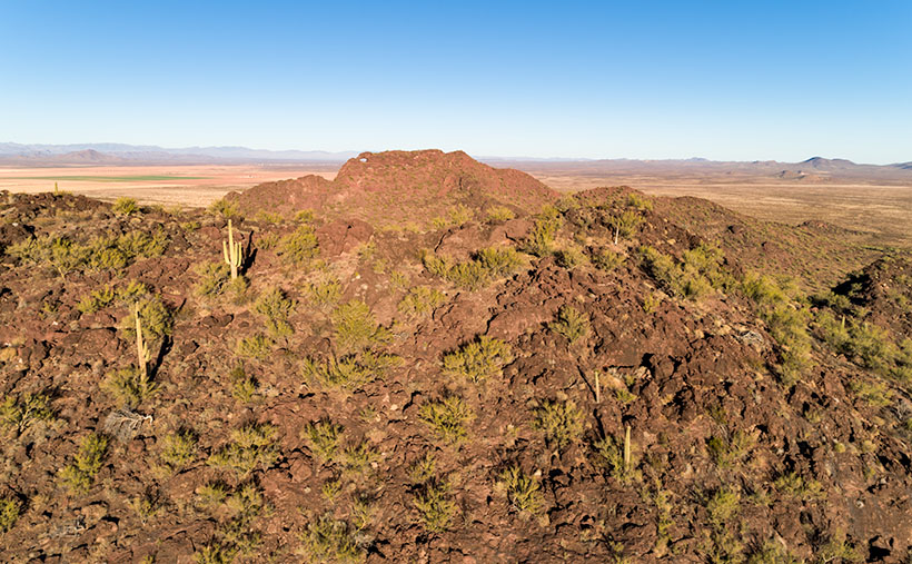
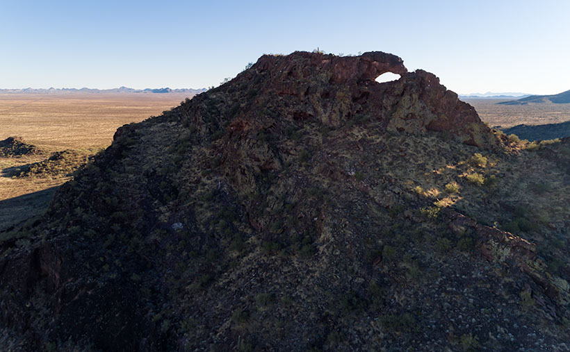
Letting my romance wilt on the vine, let’s talk about this week’s featured image. As I promised last week, I wanted to show you the Eagle Eye Arch from another angle. In this image—that I call Eagle Eye East—we’re looking at the arch from the south side of the mountains in Aguila. I shot this picture from the top of Eagle Eye Mountain facing Eagle Eye Peak, and that’s why the arch seems more distant than last week’s photo. Since this was the sunny side of the mountains, it better shows how rough the lava surface is. I like how the bright green saguaro and palo verde contrast with the reddish-brown rocks.
Another interesting thing in this image—to me—is the background mountains. The Forepaugh Range is on the right and beyond them is the town of Wickenburg. Beyond the Aguila Valley, the tall mountains on the left horizon are the Weavers, and that’s where we call home.
You can see a larger version of Eagle Eye East on its Web Page by clicking here. Be sure to come back next week, and I’ll show you the final shot that I liked from my outing in Aguila.
Until next time — jw