Poachie Yucca Bloom Picture of the Week

Sometimes it’s frustrating to talk to foreigners—that is, people that live outside of Arizona, especially someone that has never visited here. When they find out you’re a Zonie, they turn their noses up, and usually, something like this falls out of their mouth, “How can you tolerate that heat, sand, and barren desert?” To them, our state is one homogenous sandbox inside an oven. They never ask, “Where in Arizona do you live?” That’s because no one has educated them about how diverse the state is.

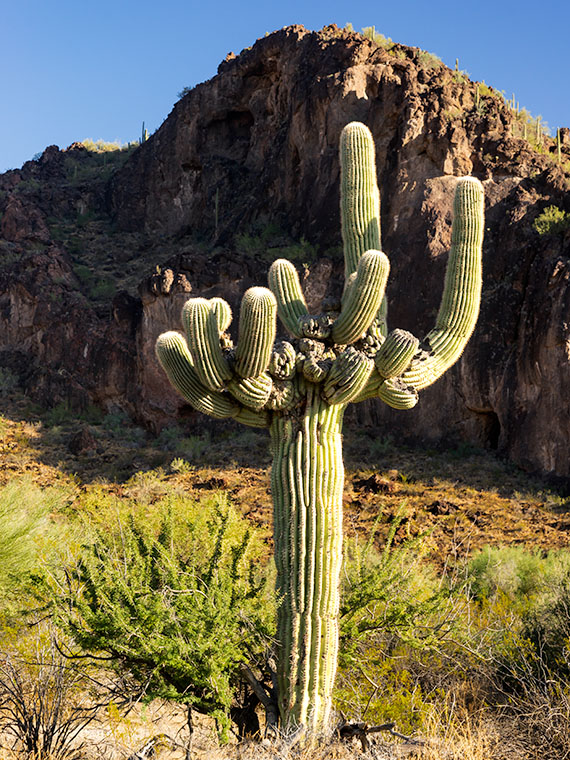
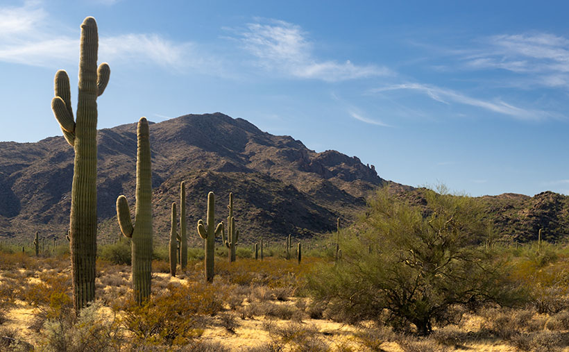
Arizona has every climate zone but two: the Tropic and the Arctic zones. If you want to freeze your butt off, you’re out of luck, but San Diego is a good enough substitute for the tropics—at least for us. If you need something more hot and sweaty, you can always rent Cannibal Women in the Avocado Jungle of Death from Amazon, but I digress. Seriously, we have snow-capped mountains, high plateaus, transition grasslands, and four kinds of deserts. What more do you need?

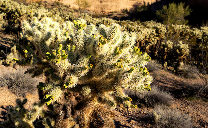
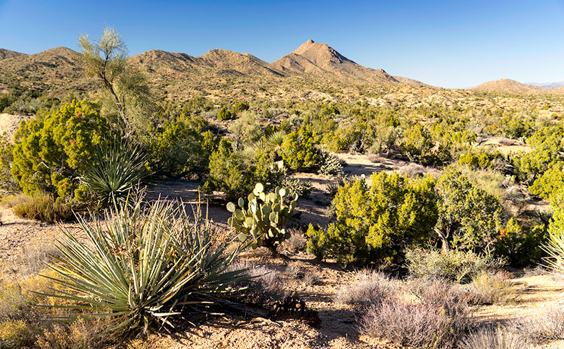
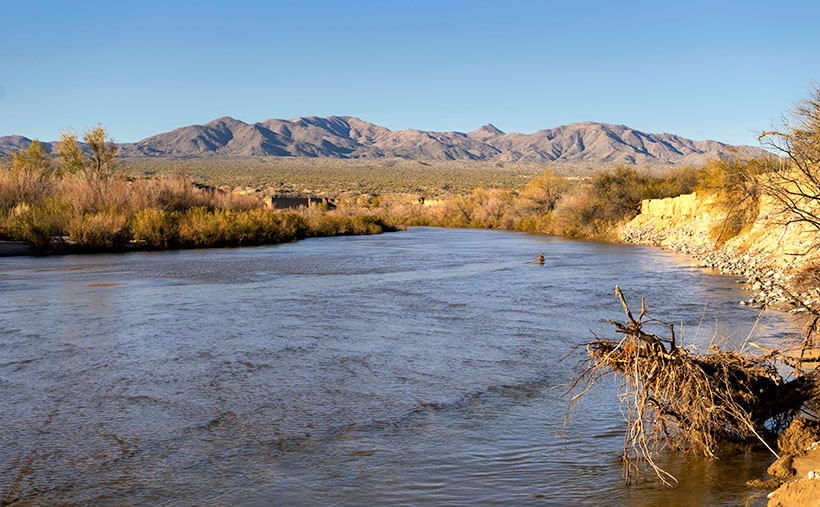
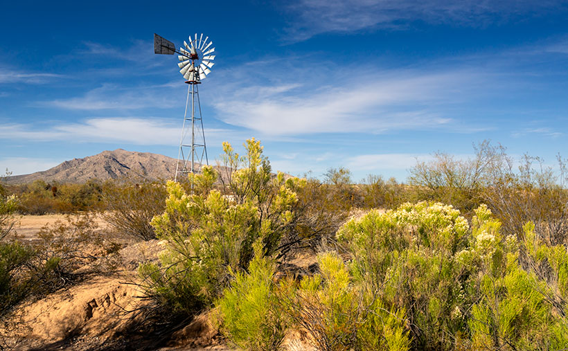
After making these back road junkets for over a year, I’m finding out that there are even pockets of places that are different than what I expected to find there. Locations with their micro-climate, because they get more or less sun, wind, or rain than their surroundings. That’s what I got from this month’s trip over the Poachie Mountains. We saw water in a dry river, and evergreens growing alongside tall saguaros.

Poachie Yucca Bloom - A yucca high in the Poachie Mountains that still has its flower stalk.
Poachie Yucca Bloom – A yucca high in the Poachie Mountains that still has its flower stalk.

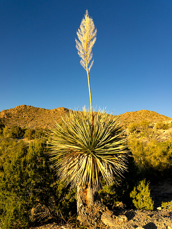
That brings us to this week’s featured image. It’s a photo of the ubiquitous yucca, a plant found throughout the southwest. They’re most photogenic when in bloom, which is spring. The yucca sends out a shoot with white edible flowers (but not raw) that fall off after pollination, and the seeds disperse in the wind. After all of the sex part is done, the stalk dries and falls off. In this case, the stem is still there, long after I believed I could get a shot like this.

Another thing about photographing yucca, they are always too far of a hike, surrounded by other plants, or not as symmetrical as this specimen. Whoever planted this one put it in a spot specifically for lazy photographers. I tip my hat to you, Mister Gardener.

You can see a larger version of Poachie Yucca Bloom on its Web Page by clicking here. I hope you enjoy viewing it. Join us next week as we travel down another one of Arizona’s back roads.

Until next time — jw

Cholla Bay Picture of the Week

After being stopped by a river that rarely has flowing water, we spent some time along the bank of the Big Sandy, watching the calm, almost clear water flowing on its way to Alamo Lake. Queen Anne broke out a couple of water bottles, and we shared a trail bar while perusing the map to find our options.

This would have been a perfect picnic spot if we had packed a basket. Imagine sitting on a blanket in the middle of 17 Mile Drive, where it disappears beneath a river. We could see a couple of houses nearby, and later, I found out that we were in Greenwood—the site of yet another abandoned mining community. In its heyday, some three hundred souls lived and worked here. The town—named after the abundance of Palo Verde trees—didn’t last long because of its low-quality ore.

We turned around and started our journey home with the day getting late. We dallied along the way, making many stops for photos. Before the road began the ascent up the mountain, I spotted where the Big Sandy River had scoured 30-foot cliffs out of the mud banks. The formation was nearly circular, and you could imagine the raging water churning in a back eddy, a swirling whirlpool flowing against the river’s current. A large grove of Teddy Bear Cholla was growing inside the containment, so I grabbed my camera and hiked in for a shot.

Cholla Bay - The most dangerous cactus will attack you at the slightest provocation.
Cholla Bay – The most dangerous cactus will attack you at the slightest provocation.

I have a love/hate relationship with the cholla cactus. When backlit, it has a soft fuzzy look that makes you want to jump into it like a pile of autumn leaves. It’s also known as Jumping Cholla, but it doesn’t do that. Its outer joints are fragile—hair trigger, if you will—and the tips break off from the main plant with the slightest disturbance. The needles are barbed, so if you get some into your skin, you have to pull them out with pliers—one by one.

Whenever I’m near Cholla, I move slowly and cautiously. I watch the ground for snakes, cow pies, and cholla balls. It’s like walking a tight wire. I don’t look up until I stop walking. So imagine how startled I was in the middle of this field when a wild gray burro popped his head up and snorted. He was just as frightened as I was and quickly galloped off to the far side of the road, but it took all my self-control not to stumble back through the cactus patch. Once the two jackasses safely separated, I regained my composure and took this picture, which I called Cholla Bay.

You can see a larger version of Cholla Bay on its Web Page by clicking here. I hope you enjoy viewing it. Join us next week when we finish our trip to the Poachie Mountains.

Until next time — jw

Greenwood Peak Picture of the Week

I have two reasons for these monthly jaunts on Arizona roads I’ve never traveled. The first is to give me a reason to get out and shoot. The other purpose is to force me to explore places I haven’t seen, see what’s out there, and see what I haven’t seen.

What was new to me on this trip was seeing saguaro growing among the Juniper. Think about it. The mix of those two plants never happens. The saguaro stops growing at about 3000 feet because they don’t tolerate frost. To be in a field of Juniper, you’d have to travel to Sedona, Prescott, or Payson. I yammered on and on about this phenomenon, Anne, as 17 Mile Road twisted up into the Poachie Range. At one point, I was so confused that I stopped and pulled out my Garmin to check the elevation.

Greenwood Peak - One of the two prominent peaks in the Poachie Mountain Range. This one can be seen if you travel through Wikieup.
Greenwood Peak – One of the two prominent peaks in the Poachie Mountain Range. Greenwood Peak can be seen on the western horizon if you travel to Wikieup.

The Poachie Range is 30 miles long, and you see them west of U.S. 93 between Nothing and Wikieup. They’re not very tall, with its tallest peak being Arrastra Mountain at 4807 feet. So, I usually wouldn’t expect to see Juniper this low. When I checked my GPS, the elevation was 3600 Feet. All this leads me to believe that winters aren’t severe here, but more rain falls here than on the desert floors. Anyway, that’s my story, and I’m sticking to it.

The road we traveled crossed the Poachie Range south of its prominent northern peak—Greenwood Peak. It’s the subject of this week’s featured image. It only rises to an altitude of 4300 feet, but it still provides a handsome backdrop for the unusual mixture of cactus and evergreens.

You can see a larger version of Greenwood Peak on its Web Page by clicking here. I hope you enjoy viewing it. Join us next week as we finish our trip to the Harquahala Mountains.

Until next time — jw

Big Wet Sandy Picture of the Week

“I know a shortcut.”

How many of you have heard those words and broken into a cold sweat? The road that Queen Anne and I decided to explore this month didn’t start as a shortcut. It was supposed to be a much longer trip, but it got cut short.

I had intended to drive to the north shore of Alamo Lake. There are a couple of exciting mountains I’ve seen from across the water when I last visited. The best road to get there starts in Wikieup. On my maps (including Google), there are two ways to get there. One is twenty miles south of Wikieup, and the other is about five miles south. Both roads go to the little town of Signal. I’m sure you spotted the signs on a drive to Las Vegas.

We decide to take 17 Mile Drive road. It’s the first left after the Nothing Gas Station. It’s a wide well-graded dirt road that climbs over a pass in the Poachie Mountains, then down into a valley where Signal is. The scenery at the pass is amazing—something we’ll get to later—and you can drive the route with your family station wagon. There’s one hitch along the way, and that’s crossing the Big Sandy River at Greenwood. Usually, crossing the river here could be tricky because—well, it’s deep sand, and you might get stuck without four-wheel drive.

Big Wet Sandy - The normally dry Big Sandy River flowing with water from recent rain.
Big Wet Sandy – The normally dry Big Sandy River was flowing with water from recent rain.

That wasn’t the case today. The Big Sandy was a real river and not in an ugly flash flood kind of way. Its waters flowed like it was an old river; clear and quiet. If I didn’t know better, I might have been tempted to pull out my waders and fly rod and make a few casts. It wouldn’t have been my worst day fishing, being the great angler that I am. There was no way to tell how deep the water was. It could have been two feet or a dozen, but it was not tempting enough for the police to cite me under the Stupid Motorist Law.

So, we’ll begin this month’s journey at the end and go backward. As I said, there was enough material to shoot in the mountains to fill a month, so we’ll save Alamo for another month, and we’ll start at the water’s edge.

I took this week’s featured image standing on the river’s bank. If I didn’t know, I would venture a guess that it was a photo of the Colorado River south of Bullhead City, and the mountains were in Nevada. Nope, it’s all Arizona. We’re looking north-east, and the peaks are actually on our side of the Big Sandy. The high point is Burro Peak. Although everything appears calm on this warm winter afternoon, the banks on each side of the water show erosion from raging water at some time. There are more cliff-banks like this—some higher—along the riverside past Wikieup that you can see from Highway 93. I wonder if I’ll ever again see a sight like this.

You can see a larger version of Big Wet Sandy on its Web Page by clicking here. I hope you enjoy viewing it. Join us next week as we start our return over the Poachie Mountains.

Until next time — jw

What Happened to You Picture of the Week

Arizona has a reputation for being hot—deservedly so. Especially here in the Sonoran Desert. We frequently make the weather news for hosting the highest temperature of the day—a contest in which Gila Bend and Bullhead City are always locked in battle. For some people, any press is good press.

But as I explore the back roads of our state, I’ve come to the conclusion that the heat here had to be way worse many millennia ago. I came to this conclusion because you can’t walk more than ten steps before you step in a puddle of cooled lava—basalt (cooled quickly on the surface), andesite (mixed cooling), and granite (cooled slowly beneath the surface). Not all of this volcanic activity happened at the same time of, course. Millions of years separated eras of activity. What I’m saying is that, at times, Arizona’s ground heat far exceeded our summer temperatures. It’s probably a good thing that we’re living in this era.

The reason I’m hopped-up on geology this morning is because of the next stop that Queen Anne and I made on our one lap of Harquahala Mountain trip. Near where the Eagle Eye Road intersects with the Salome Highway, a series of volcanic hills line the south side of the road. After getting out and clambering all over them, I decided that they didn’t have star power. They’re interesting, but not that interesting. During my investigation, however, I found this poor little weird saguaro. It had eight new arms growing around it’s lopped off the top—sort of like last month’s headless version. As I got closer, I saw that the new arms were growing from other truncated arms—at least a dozen of them. It was—much like a cat eats grass to settle its stomach—like a T-Rex chomped off its top, so the saguaro put out new shoots. I remember thinking, “What the hell happened to you?” Was this caused by freezing, disease, or repeated lightning strikes? I don’t know, I’ve never seen a saguaro like this.

What Happened to You-a poor little saguaro has arms growing out of damaged arms. What caused this to happen?
What Happened to You -A poor little saguaro has arms growing out of damaged arms. What caused this to happen?

I decided to capture its portrait, and, as I framed it, the hills came in play. I lined up my shot so that the sunlit saguaro was centered on the dark rocks on the outcrop. I was so impressed with how clever I was, I also shot a dead tree and palo verde in the same way, but they didn’t come out as well. I titled this shot What Happened to You, and it’s this week’s featured image.

You can see a larger version of What Happened to You on its Web Page by clicking here. I hope you enjoy viewing it. Join us next week as we finish up our trip around the Harquahala Mountains.

Until next time — jw

BTW: Queen Anne and I wish you and your loved ones Bah Humbug—and similar salutations of the season.

Desert Broom and Windmill Picture of the Week

I’ve spent a lot of time in the desert recently. I’m less likely to run into snakes now that the weather is colder. But, there’s still a lot to be wary of when you’re out in the wild. There’s the cactus, especially the Jumping Cholla, the barbed wire, and all the illegal garbage scattered along the trail. One of the most frequent things I have to avoid is all of those cow pies. As I move, my eyes are on the ground; then, I stop to look up to get my bearings. There may not be a cow within miles, but their droppings are everywhere. I Googled it and found a state agricultural Website that said, “Grazing fields account for 73% of total land use in the state and 98% of its agricultural landholdings.” That’s a lot of free-range lands.

Desert Broom and Windmill-The picturesque windmills don't provide an efficient supply of water to cattle as water tables drop
Desert Broom and Windmill-The picturesque windmills don’t provide an efficient supply of water to cattle as water tables drop

You can tell ranching in Arizona is a big deal by the number of windmills and clumps of green trees you see as you drive down the highway. The green areas are usually associated with stock-tanks—the ranchers plow low dams on washes to retain the run-off, and the windmills pump groundwater into large metal tubs from which the herd gets a drink.

Not many of these windmills actually spin these days, regardless of how much the wind is blowing. Some of that is because the water table is dropping. There has been an ongoing drought here, and we’ve pumped enormous amounts of water out of the ground over the years. Instead of drilling the wells deeper, ranchers disable the windmills and truck water in to fill the tanks.

On our “One Lap of the Harquahala Mountains” tour that Queen Anne and I did last month, I was challenged with either shooting the mountain repeatedly, or finding interesting things that broke the monotonous sea of creosote, so when I saw this windmill off in the distance, I hiked in for a shot. When I got there, I liked the shiny metal fan against the sky, but I wasn’t impressed with its doughboy style galvanized tank. It looked as if thirsty bovine stampeded over it. Luckily there was some desert broom nearby that helped in a couple of ways. The green plants were in bloom—that’s as close as you get to fall color in the Sonoran Desert, and they camouflage the damaged tank.

I named this week’s featured image Desert Broom and Windmill. I like how the light was beginning to come in and how Harquahala Mountain shows in the background. I’m also partial to the high cirrus clouds, so I was pleased that they frame the windmill’s blades.

You can see a larger version of Desert Broom and Windmill on its Web Page by clicking here. I hope you enjoy viewing it. Join us next week as we continue along our trip around the Harquahala Mountains.

Until next time — jw

Saguaro at Harquahala Mountain Picture of the Week

I was researching today’s post, and I found some interesting statistics—at least they are for me—and on an online forum thread that made me smile. In case you hadn’t noticed, I like mountains. I like them big or small, a long chain of peaks or lonesome butte, snow-covered volcanoes or desert ranges. I like them because they’re not flat and they’re visually stimulating. You can gauge travel distances with them. I’d be a terrible mariner out on the sea without landmarks. When I travel through Kansas, I have to replace peaks with grain silos.

I want to learn more about what I see and photograph. I want to know the peak names, their heights, their make up, and how they formed. Most of my curiosity is satisfied with topographic maps, but the geology stuff is gobbledygook.  I wish there were an easy decoder book written for simpletons like me.

The Harquahala Mountains—the subject of this month’s images—are a substantial range, one of the highest in Arizona’s southwest quadrant. I can see its distinctive round shape from my back porch. I started tagging my films with the name Harquahala Studios because it’s fun to say: HARK—qua-hala. Last week I learned that the name in the Mohave language means “water, up high” presumably from the springs on its slopes—a handy fact to know if you live in the desert.

I Googled “Arizona Mountains” this morning and found it listed in the 5,000-6,000 foot elevation group. To find the exact answer that I wanted would have required more research, spreadsheets, and an effort that cut into my nap, so I gave up. But I saw another question in the list that piqued my curiosity. “Which state is most mountainous?” What’s your guess? Set aside Alaska because they don’t play fair. Is it Colorado, California, or Montana? In the discussion, some people were arguing that it’s West Virginia, which is in the Appalachians, and the highest peak is under 5,000 feet—hardly a mountain. They explained that the little state has the lowest percentage of flat-land, so it’s all mountains, therefore the most mountainous.

The answer wasn’t Colorado; California has 500 more named peaks, and Montana is two-thirds prairie that the locals call West Dakota. The response surprised me, but since I read it on the internet, it must be true. Being entirely comprised of the Great Basin Desert with north-south running ranges, Nevada has the most named peaks in the lower forty-eight. They’re not the highest, but there’s a gob of them.

Saguaro at Harquahala Mountains-A line of saguaro looking like telephone poles lead your eye to the massive mountain south of Aguila, Arizona.

This week’s featured image is called Saguaros at Harquahala Mountain, and I shot it south of Aguila, a few miles south of the Eagle Eye Peaks in last week’s post. What made me stop to take this image was the line of saguaros that looked like a row of telephone poles. They create what’s called a leading-line—a perspective tool that brings your eye into the massive mountain. The clouds and the small Palo Verde tree work to keep your attention in the picture’s center—if it works right, your eye moves in a clockwise circle.

You can see a larger version of Saguaro at Harquahala Mountain on its Web Page by clicking here. I hope you enjoy viewing it. Join us next week as we continue our lap around the Harquahala Mountains, and remind me to stay out of the flooded washes.

Until next time — jw